Johnstone Strait – 2011 South Coast BC Trip
October 7th, 2011 | by Marilyn | Published in Ship's Log
The typical summer weather forecast for Johnstone Strait is “Strong wind warning. Light wind, becoming NW 15-25 knots in the afternoon and building to NW 25-35 in the evening.” I guess most days there is a chance that a strong onshore flow will be funneled down the ~80 mile long strait. The resulting waves can be fierce if the wind opposes the current, which is the other notable thing about Johnstone Strait – it is ~ 2 mile wide fast flowing reversing saltwater river, complete with rapids in a few places. The “river” direction switches 4 times a day as the tide changes (except in the spring when there is a lot of river runoff, and then the fresh water outflow may overcome the saltwater inflow…)
So, to make it through in a sailboat that typically cruises at about 5-6 knots, you need the current with you and ideally a wind behind you so you can sail (preferably a wind that’s not in the 30-40 knot range). That means an ebb tide with SE wind on the way north, and a flood tide with NW wind on the way south. Oh, and you need to time the journey so you reach the worst rapid – that is Seymour Narrows – at slack water else you’ll run the risk of being swamped by the eddies, boils and whirlpools. Seriously. Seymour Narrows currents can reach 15 knots and the passage is only 750 meters wide. It used to have a dangerous rock mid channel (called Ripple Rock) about 3 meters below the surface. It caused many a big ship to sink, until they blew the rock up in 1958 – do a search and read about this, it was an amazing feat!
Anyway, back to our little boat. All these logistics, and trust in weather and tidal forecasting, can be a little daunting. Nearly every cruising guidebook reckons it’s better to stay out of this area, not only because of the challenges I list above, but because it has a “parade” of all types of boats all summer long, from cruise ships to fishing boats. Most cruisers take the northern “smooth water” route, which transits many more dangerous rapids, but you don’t have to contend with the “parade of boats” and typically the winds are not as strong.
Well – we traversed Johnstone Strait to Havannah channel, twice in fact – and I would do it again. It like what I imagined after reading the guidebook warnings. It was beautiful undeveloped area surrounded by mountains. The conditions ranged from boring (on the windless outbound journey) to exciting (during stronger wind and fog/rain we experienced in the morning of our return).
First – about the “parade of boats”. On our outbound journey on the Saturday of Labor Day weekend, we saw one cruise ship that transited Seymour Narrows at slack. We had to wait for it to pass, and then we went through. No big deal. The rest the day, I think we saw 2-3 tugs, and maybe 4-5 fishing boats. So I wouldn’t call it crowded and we had no problem sharing the channel with “the parade”. It was similar on our return journey, though on that day we saw more recreational boats as we all scurried back before a series of bad weather arrived, and one cruise ship after we “exited” the strait into Nodales channel for our journey to Desolation Sound.
Second – the wind forecasts. I am certain it can get very nasty in Johnstone Strait. But for several weeks I listened to the forecast predictions, and the daily condition reports at Chatham Point and Fanny Island, and typically the forecasts are much more severe than the reality. Now transiting the strait twice does not make me an expert, and in addition to our careful planning, we probably got lucky. On our outbound journey, the water was mirror smooth and we had to motor the entire way to from April Point to Port Neville (48 nm). A knowledgeable local said he had never experienced such conditions, that it is ALWAYS rough where Chancellor Channel enters Johnstone Strait – but it was smooth for us. On our return journey, certainly that Chancellor Channel area was the roughest spot, with 15-20 knot winds opposing a 1-2 knot current and turbulence due to the combining channels, but it was fine in our sailboat as we motor-sailed downwind. (There was not enough wind to power through the rough patches earlier in the day as we approached Current passage at the last of the ebb, so we resorted to motor sailing. But later when the current was flooding (and so with us) and the wind improved, we switched off the motor later and had a lovely sail.)
And finally – the current and rapids. Just transit a saltwater rapid near slack and you won’t even know it’s a rapid. In most of the Strait where there is laminar flow, you fly along in the 2-4 knots of current and make great progress. When travelling at about 5 knots like we do, it’s tough to time your journey for a slack water transit of both the rapids near Helmkin island and Seymour Narrows, which are about 33 nm apart. But Race/Current passages near Helmkin are relatively easy to transit when you reach them if you base your schedule on slack water at Seymour Narrows.
So – Johnstone Strait requires a lot of planning and careful timing, but based on our experience, with good preparation and flexibility concerning your transit dates, it is fine for a cruiser to use this route to get to the Broughtons and beyond. Just be ready to “exit” into any one of the several channels that join Johnstone Strait along the way if the conditions get more severe than your boat can handle, and let Nature dictate your movements rather than your personal holiday schedule.
The coolest thing that happened on our journey through the Strait was the porpoises came alongside and played in our wake – many times! You can watch a video of this here. We’ve never experienced this before. They joined us in two different places, both in locations where there was some turbulence so they must have been feeding nearby. I guess they do it for fun and not to scare us away from their food – they stayed with us for quite some time and we sure enjoyed watching them!
Next area: Broughtons
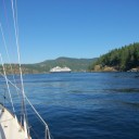
- We had to stay out of the way of this cruise ship before we could transite Seymour Narrows. They moved fast, so our delay was short.
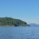
- Chatham Point is a major waypoint enroute. It is the end of Discovery Passage and the start of Johnstone Strait.
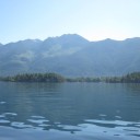
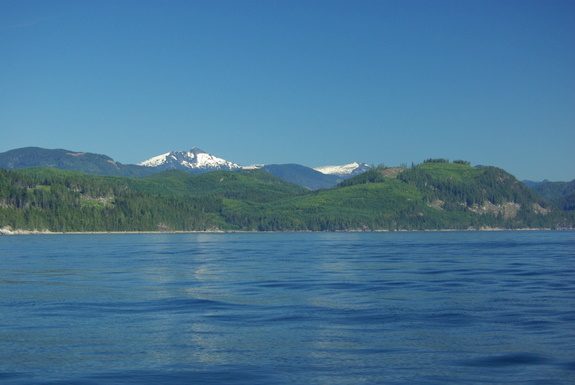
- Notice how smooth the water is in Current Passage. This was an extremely calm day in Johnstone Strait.
- On our outboard journey, after transiting most of Johnstone Strait, we spent 2 days at Port Neville. On the morning we left, there was some beautiful fog, that would have made navigating difficult, but it lifted before we left.
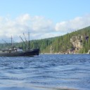
- We had good wind on the afternoon of our return, so we were able to sail. These folks from Alaska were also enjoying the day.
